AI in action
Product innovation
Tracing our impact
Marketplace principles
Inside scoop
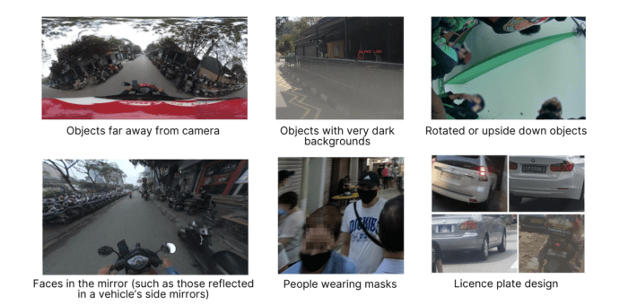
Blurring faces and licence plates in street-level images to protect privacy
.
June 22, 2023
.
Regional


About
Consumer
Merchant
Enterprise
Quick Links